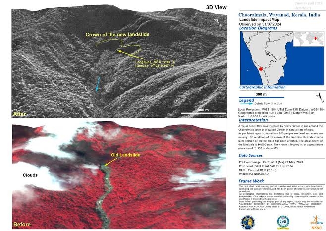
The ISRO's National Remote Sensing Center (NRSC) in Hyderabad has released high-resolution satellite images of the landslide-affected area of Wayanad which show widespread damage. The NRSC has released before and after photographs of the July 30 landslide of Chooralmala in Wayanad district. The photos show that the landslide displaced about 86,000 square meters of land.
Home /
Story of the day
/ Wayanad landslides: ISRO releases picture of 86,000 square meters land devastation


48.jpeg)
70.jpeg)
90.jpeg)
345.jpeg)
152.jpeg)
233.jpeg)
479.jpeg)
623.jpeg)
10.jpeg)


